


Crau
 |
CH (VD), 7.1345°E, 46.4492°N | |||
 |
1554 m |  |
CH-VD-1554 | |
 |
Devant de l'Étivaz, 6m, 1110km | |||
 |
||||
 |


| |||
 |
no path on the north side (but possibility to to ride via Sur le Grin to head then down to Gérignoz) | |||
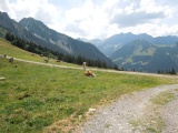
View looking south from Crau (Sarouche hut), showing the mountain range stretching from La Cape au Moine to Le Châtillon, with La Coumatta on the left | ||||
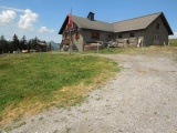
Sarouche Hut | ||||