


Les Craux
 |
CH (VD), 7.1556°E, 46.4673°N | |||
 |
1081 m |  |
CH-VD-1081 | |
 |
Gérignoz, 980m, 1km | |||
 |
Gérignoz, 980m, 1km | |||
 |
 |
 | ||
 |


| |||
 |
intermittent trail on the north side, road access on the south side | |||
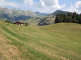
Les Craux, with the Vanil Carré to Vanil Noir mountain range in the background | ||||