
 MTB tour Davos - Strela - Maienfelder Furgga - Davos (25 September 2016)
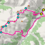 |
33 km |
| 1430 m ^ | |
 |
Strelaalp above Davos 25-09-2016 10:56 9.8172°E, 46.8056°N, 1980m |
 |
Strelapass, climbing from the south-east (from Davos) 25-09-2016 11:33 9.8003°E, 46.8094°N, 2290m |
 |
From Strela towards Weissfluh and Weissfluhjoch, with the Schiahorn on the right-hand side 25-09-2016 11:44 9.7961°E, 46.8131°N, 2350m |
 |
Sapün and the Schanfigg valley as seen from Strelapass 25-09-2016 11:45 9.7958°E, 46.8133°N, 2360m |
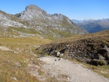 |
View from the Strela lake towards Schiahorn 25-09-2016 12:06 9.7903°E, 46.8064°N, 2405m |
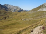 |
Latschüelfurgga as arriving from the east 25-09-2016 12:12 9.7872°E, 46.8044°N, 2420m |
 |
View from Latschüelfurgga towards Davos 25-09-2016 12:18 9.7772°E, 46.8019°N, 2409m |
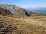 |
From Wannengrat to the west, left with the crest of Mederger Flue and right the Schanfigg valley 25-09-2016 12:28 9.7761°E, 46.7967°N, 2451m |
 |
View from Chöbschhornhütte towards Schwifurgga, between Schafgrind and Medergerflue 25-09-2016 12:45 9.7675°E, 46.7883°N, 2575m |
 |
View from Schwifurgga towards Chörbschhorn and its hut 25-09-2016 13:10 9.7519°E, 46.7875°N, 2519m |
 |
Schwifurgga and Medergerflue 25-09-2016 13:10 9.7519°E, 46.7875°N, 2519m |
 |
Tiejerflue and Arosa as seen from Schwifurgga 25-09-2016 13:11 9.7519°E, 46.7875°N, 2519m |
 |
iew from Schwifurgga towards Bodmenfurgga (in the centre), with Schwarzhorn and Tiejerflue on each side of Tiejerfürggli (with snow) 25-09-2016 13:12 9.7519°E, 46.7875°N, 2519m |
 |
Schwifurgga from Bodmenfurgga, the trail between both going through the lower left-hand side of the picture 25-09-2016 13:46 9.7453°E, 46.7817°N, 2529m |
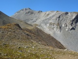 |
Tiejerflue from Bodmenfurgga 25-09-2016 13:46 9.7453°E, 46.7817°N, 2529m |
 |
View from Tiejerfürggli to the north-east, with Schwifurgga left on the second ground 25-09-2016 14:10 9.7386°E, 46.7806°N, 2664m |
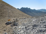 |
Tiejerfürggli and Amselflue 25-09-2016 14:11 9.7386°E, 46.7806°N, 2664m |
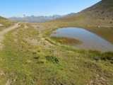 |
Maienfelderfurgga, from west to east 25-09-2016 14:30 9.7331°E, 46.7703°N, 2434m |
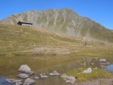 |
Maienfelderfurgga and Schwarzhorn 25-09-2016 14:33 9.7331°E, 46.7700°N, 2434m |
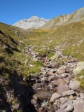 |
Chummerbach brook and Tiejerflue summit 25-09-2016 14:38 9.7389°E, 46.7697°N, 2370m |
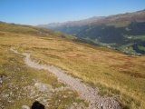 |
Above Chummeralp 25-09-2016 14:59 9.7650°E, 46.7664°N, 2260m |
 |
Stafelalp with the Jakobshorn summit in the background 25-09-2016 15:26 9.7836°E, 46.7700°N, 1900m |