


Col de Perty
 |
FR (26), 5.5499°E, 44.2873°N | |||
 |
1303 m |  |
FR-26-1302b | |
 |
Montauban-sur-l'Ouvèze, 728m, 11km Ruissas, 844m, 9km | |||
 |
Laborel, 827m, 9km | |||
 |


")
| |||
 |
one of the highest passes of the region, with sight to the Ventoux and, on the other side, to the Alps | |||

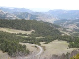
Col de Perty, view to the west (to St-Auban) | ||||
Col de Perty, view to the east | ||||