


Col de la Sine
 |
FR (06), 6.8612°E, 43.7595°N | |||
 |
1108 m |  |
FR-06-1108 | |
 |
Andon, 1195m, 9km Pont du Loup, 1070m, 6km | |||
 |
St-Vallier-de-Thiey, 710m, 12km Col du Ferrier, 1039m, 7km | |||
 |


")
| |||
 |
between the valleys of Loup and Nans | |||
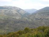
View from Castellaras pass towards Sine pass | ||||

The Sine pass as approaching from the north | ||||