


Gwidemhöchi
 |
CH (SO), 7.8075°E, 47.36°N | |||
 |
998 m |  |
CH-SO-0998 | |
 |
Langenbruck, 697m, 4km | |||
 |
Hägendorf, 428m, 6km Fasiswald, 696m, 2km | |||
 |
||||
 |


")
| |||
 |
track partly very steep between Fasiswald and the pass, apart from this well rideable | |||
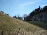
Gwidemhöchi | ||||
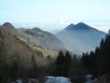
View from Gwidemhöchi to the east, with the double summit of Homberg | ||||
Gwidemhöchi, view to the east | ||||
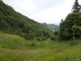
Gwidemhöchi, view to the west | ||||